Friday, October 9, 2020

Crater Lake National Park

The Best Western in La Pine, Oregon was very nice. We were all very tired after all of our walking on Thursday, so we struggled to stay awake until 9 pm. We slept very well, woke around 5:30 am and made our way to the hotel’s hot breakfast a little after 6. They had scrambled eggs, biscuits, sausage and gravy as well as other available items. 

Crater Lake National Park
Mark and Cindy came to our room shortly after we returned from breakfast, so we left for Crater Lake National Park by 7:30. We arrived at the park a little after 9 am. Our first stop was at an overlook entering the park. The air temperature was 43 degrees, so we were happy to have long pants, sweatshirts and jackets. Smoke from the fire coupled with morning fog made visibility an issue. We could see Wizard Island in the center of the lake but could hardly see the other side of the lake. We learned that Crater Lake is the deepest lake in the US at nearly 2000 feet deep. Wizard Island is a small volcano that formed in the caldera after the main volcano blew off. We were standing at over 7000 feet in elevation, and the air temperature was around 43 degrees. When standing in the sun, we felt pretty good, but when a gust of wind came, it was chilly.

Wizard Island in Crater Lake
We drove to the park visitor center in Rim Village and walked around some of the short trails and paths while waiting until the visitor center opened at 10 am. We saw a lot of evidence of forest fires from prior years. On the road into the park, almost all the trees on the west side of the road were burned and dead. Because the road acted as a firebreak, there was virtually no fire damage to trees on the east side of the road. Mary was disappointed that they did not have a stamp for her National Park Passport, but a ranger gave her a Junior Ranger sticker to put in place of the stamp. Mary and Cindy browsed the gift shop where Cindy picked up a couple of gifts for Peter and Nicholas. Mark and I walked around outside.

Phantom Ship in Crater Lake
We drove around the Rim Road encircling crater, then parked to take the architectural tour of the buildings on the Lady of Woods Trail. A trail guide told the history of each of the park’s buildings and how they were used in the past as well as their roles today. From there we took the short drive to the Sun Notch Trail that took us to overlooks of the lake.  We could see the Phantom Ship, a large rock in the lake that looked like a sailing ship. We saw a few other hikers on this trail, and most were wearing face masks. We then drove to the Phantom Ship Overlook where we ate our usual peanut butter and cracker lunch with Mark and Cindy. There was still a good bit of smoke, so we didn’t have a great view of the lake from there. 

Pumice Castle overlooking Crater Lake
The next stop was the Pumice Castle Overlook where a large pumice formation on the inner wall of the crater looks like a stone castle. This formation hung high above the lake at the bottom of the crater. After we took some photos Mark and Cindy decided to start back toward home, so we drove to the Pinnacles area of the park. This area is a steep canyon with tall slender fumaroles looking like giant smokestacks. As we walked the Pinnacles Trail, we were pleased that there wasn’t much smoke in this canyon so we had a great view of pinnacles. There were two young women with a child about 4 years old. Like most boys his age, he ran everywhere he went. We were worried because the canyon dropped off sharply just off the path. If the boy would trip he might easily fall hundreds of feet to the canyon floor. The two women did not seem too concerned and, fortunately, the child didn’t fall.

Pinnacles at Crater Lake
We left the park by the southern entrance on US 97 and continued south toward California. We stopped at Klamath Falls, Oregon, for gas before we entered California with higher prices. We picked up I-5 near Weed, California and drove less than an hour to the Travelodge in Redding, California. We were happy to hear that the grass fire in Weed had been extinguished and didn’t cause a delay in travel.

The Travelodge is not the best motel, but it is convenient. We hope that it is quiet tonight because we are very tired.

For dinner, we walked to the nearby Janya’s Thai Cuisine Restaurant. We split an order of Pad Si Ew which is Mary’s favorite, and each had two spring rolls. We both enjoyed the meal, and it was about the right amount of food for both of us.

We are looking forward to Lassen National Volcanic Park tomorrow. We loved it when we were there in 2011 and plan to walk several trails tomorrow before going to David and Yeh’s house Saturday evening.


Thursday, October 8, 2020

Newberry National Volcanic Monument

After sleeping well at the Whittingtons. we awoke and had breakfast before driving east toward Newberry National Volcanic Monument. We planned to hike into the caldera of the ancient volcano that collapsed and now holds beautiful high desert lakes.

Acres of obsidion
Mark and Cindy drove ahead of us in her new Audi, and we parked in the lot of the La Pine Best Western where we would be spending the night. All four of us got in Cindy’s nice car and headed up US 97 to the National Park.

Obsidian glass


The lava caves were closed for the winter to allow the resident bat population to hibernate. We decided that our first hike of the day would be the Big Obsidian Flow Trail, which is a one-mile loop through a 700-acre field of volcanic glass that is over 1600 years old. The black volcanic obsidian looked just like the waste glass at Blenko and was very sharp. Part of the trail went through a field of pumice formed from more slowly cooled lava. The very soft and lightweight pumice was very different from the obsidian of the same lava flow.

View from Little Crater Trail
We walked from the Big Obsidian Flow trail to the 1.8-mile-long Little Crater Trail that took us on a loop with great lake views as well as a good look onto the obsidian field. The trail was a gentle up and down slope that made for a nice walk. There were only a few other hikers on any of the trails and most were masked up. A little haze from the fires in California as well as some closer fires made the view hazy.

River otter at the High Desert Museum
We got back to the car around 1:30 and had our usual travel lunch of peanut butter and crackers. We had some of Mark’s jerky and chocolate covered almonds too.

From the Newberry Volcanic Park we drive to the High Desert Museum. We were glad to get a 10% AAA discount for our group. The museum had displays on the plants and animals of the area, as well as the native people and the influence of European exploration and settlement. There were also odd displays on daredevils such as Evel Knievel, who performed many of his better-known stunts in the high desert, and on the Burning Man Festival, which takes place at the end of summer in the Nevada high dessert. The outside portion of the museum had river otters, fish and local birds of prey. There was also a recreation of an early 1900s ranch that would have been typical in the area. We all thought that the museum was very enjoyable. Mark and Cindy come here fairly regularly.

Since everyone was starting to get hungry, we drove into Bend to look for a place to get dinner. We settled on a food truck in a small food court area in a hip part of town not far from the Oregon State campus. Alebrije Oaxaca turned out to be a very good choice. Mary got a torta with roasted beef, tomato and avocado on a bolillo, and I had chicken mole enchiladas with beans and rice. Mark and Cindy split a burrito Mexican pizza with retried black beans, avocado, tomato, roast pork and cheese. We all shared some of each other’s meals and were very happy with our orders.

After the meal we drove back to the La Pine Best Western and checked in. Our rooms were comfortable, and the area was very quiet. We were looking forward to Crater Lake National Park tomorrow then on the California on Saturday.

Wednesday, October 7, 2020

Mt. Pisgah

We slept well in Robert’s room. The cool air coming in the open window felt really good.

View from Mt. Pisgah
After eating breakfast and doing a little laundry, we decided to go for a walk at a nearby county park. We decided to hike Mt. Pisgah in the Howard Buford Recreation Area, which is a Lane County park. The area has 17 miles of trails leading to the over 1,500-foot-high butte.

Since the park is very near Whittington’s house, we got there very quickly. A day camp was being held, so there was a little more traffic at the park than we expected. However, most of the camp was being held at or near the 118-acre arboretum. We decided on the Summit Trail and started up the mountain. Quite a few hikers were out, and most were wearing face masks.

Mt. Pisgah summit marker
We arrived at the summit a little after noon and found a geocache there. We sat around on some of the benches and admired the views of the Willamette Valley before starting down on a different path. The route we took was a rough narrow track that took us through fields of blackberries. We snacked on a few berries that were still on the vines as we walked downhill. The path has a lot of loose stones causing us to walk carefully down the hill. We saw several hikers coming up the hill, especially as we neared the trailhead.

We walked through the arboretum and passed small groups of children in the day camp on our way back to our rental car. We had our usual lunch of peanut butter and crackers and drank several bottles of water. To keep isolated, we ate in the rental car. We had to keep the windows open because the day had warmed since we had arrived.

When we left the parking lot, we drove to a Fred Meyer, which is part of the Kroger group, and picked up more crackers and some fresh fruit. Like many Kroger stores we have seen, Fred Meyer stores offer a large array of goods.

We got back to Whittington’s around 2:30 pm and finished the laundry. We walked around out back and looked at Cindy’s landscaping. Cindy returned home from work a little after 3 pm, so she and Mary went to their attic to sort through some items that had belonged to their parents. I did some reading and relaxed after our long walk.

Mark came home around 5 and cooked tri-tip, roast potatoes and corn casserole for dinner. It was all very good. Robert and Michael were both at the dinner which was very nice. After dinner Mary and Cindy discussed plans for Thursday’s trip to Crater Lake.

Tuesday, October 6, 2020

Silver Falls State Park

North Falls

Cindy was due to arrive at the Vancouver, Washington Amtrak station at 8:30 so we grabbed our bagged breakfast from the hotel a little early and had the apple sauce along with the raisin bran from our travel food. The only tea in the room was green tea, but we enjoyed a cup before drove downtown to the train station. We were glad to see her and knew that we would enjoy our visit with them over the next few days.

View from under North Falls

She directed us to Silver Falls State Park, about 20 miles southeast of Salem, Oregon. This nearly 10,000-acre state park was a logging community in the late 1800s but now has over 24 miles of hiking trails to ten beautiful waterfalls. Cindy paid the $5 day use fee, and we set out on the Trail of Ten Falls, ending at the South Falls plunging 177 feet. We returned to our parking lot via the Rim Trail which took us to the historical area. Before the COVID-19 pandemic, it offered concessions and events for the public. Our walk around the area and to most of the waterfalls was about 10 miles. We were back at the rental car a little after 2:30.

Lower South Falls
The trails have a good bit of elevation change, but nothing was very steep. A variety trees cover the park, but because the area was logged, none were exceptionally large. The trails are well marked and appeared to get a good deal of traffic from locals. Even though we were there on a Tuesday morning, a lot of people were out enjoying the day.

We were pleased that the smoke didn’t seem bad here at this time, although we understand that visibility was much lower just a few days earlier when winds brought smoke from the Napa fire in California as well as from fires  Oregon. Everyone is hopeful that rain will bring some relief to the efforts in controlling the fires.

South Falls
After our picnic lunch of peanut butter, crackers and the granola bars from our breakfast bags, we dropped Cindy off at the Eugene Amtrak station where she got her car then drove to her Springfield house.

It was great to see Mark and Michael and find that all were doing well. Robert was still at his new job at the trucking company. We played with the dogs, Cedar and Jade, while Mark grilled chicken. He had made a great salad that included ramen noodles, almond slivers and marinated chicken. We had local ice cream for dessert. After dinner Robert told me about his new job which is with a large trucking company that mainly transports utility poles. He performs maintenance on the large semi-trucks and flatbed trailers. He is still in the training phase of the job now but seems to enjoy it and is gaining skills as he works.

Mary and Cindy played cribbage and planned our next potential travel adventure. They are looking at possibly taking a Road Scholar trip to interior Alaska. They have several options that they were weighing for early July 2021. A lot depends on whether Mark and Cindy are able to sell the stores in the next few months, but I think they would like to make a decision soon to lock in on current prices and tour availability.

We turned in a little before 10 pm and slept well. The bed was comfortable, and the house was quiet. We are looking forward to spending more time with the Whittington family while we are here.


Monday, October 5, 2020

Mount Rainier


As we checked out of the
Olympia La Quinta, we were given “grab and go” breakfast bags that had yogurt, a water bottle, Danish, applesauce and a granola bar. We took the bags with us to eat on the road as we made our way up to Mount Rainier National Park. We stopped at a small community park along the way and ate the yogurt with the raisin bran.

Mount Rainier from Paradise Road
Our senior annual pass got us in the park for no additional fee, and we made our first stop in the former town of
Longmire. The name struck us because we had read the Craig Johnson books with the main character, Walt Longmire. The air at Longmire felt cool to us, so we changed into long pants and warmer shirts at the Ranger Station bathrooms. We could see parts of the mountain, so we were anxious to get up on the mountain and on some of the trails. Glimpses of ice and snow on the mountain top made us glad to have warmer clothes. Mount Rainier is 14,411 feet and is the second highest mountain the contiguous United States. Mount Rainier is considered an active volcano, although the last confirmed eruption was in the early 1800s.

Narada Falls
As we drove up the mountain, we feared that the fog would impede our views. However, as we drove, the fog cleared and the air warmed. We stopped at
Narada Falls, which is very near the road. The falls are beautiful, so we took some snapshots and walked around the area a good bit. We continued up the mountain drive.

The road had a lot of pull off where we took photos of the mountain along the way. Different angles showed the glaciers and waterfalls on the mountain. When we arrived at the National Park Paradise Visitor Center, we were surprised at how warm we were. This visitor center is at 5400 feet above sea level and receives nearly 54 feet of snow each year.

Myrtle Falls
We consulted a ranger for advice on some
trails that were 1.5 to 2 miles in length that would take us to scenic waterfalls and views of the mountain. Our first trail was the Myrtle Falls trail that took us up the mountain and past an attractive small waterfall fueled by snowmelt coming down the mountain. We continued past the waterfall into a mountain meadow filled with wild huckleberries. We chatted with three local ladies who said that they have been seeing a mother bear and two cubs in the meadow on most mornings. We walked up to the area where people had been seeing the bears. A fellow told us that they had been in the meadow earlier but had gone higher up on the mountain nearer the ice field. By the time we made it up to the meadow we had shed our jackets and hats since the sun was getting us warm. We made our way down the mountain to the visitor center and had lunch at a picnic table that had a great view of the mountain. Surprisingly, we had a great cell signal there, so we sent some messages to family and friends. We went into the National Park gift shop and picked up a couple of gifts.

Nisqually Vista
After lunch we went to the car to drive to the trailhead for the
Nisqually Vista Trail. This path led us to a few great spots to photograph the mountain summit as well as a stream coming off the mountain. A good many meadow wildflowers were in bloom. There were a lot of large cedar and fir trees along the walk as well as a good bit of fallen timber in the wooded area. By the time we made it back to the car, we were ready for a bottle of water and a break from walking.

Reflection Lake
We took a different path down the mountain and stopped at Reflection Lake. It lives up to its name because the water is very still and presents photographers with an opportunity to take a snapshot showing a reflection of the surrounding mountain and tree covered hills in the water.

Slot Canyon
After our quick stop at the lake, we did a short trail at a
slot canyon that is only 13 feet wide and 180 feet deep. It was incredible looking into the narrow gorge and seeing a stream so far down. We marveled at how that stream had eroded through the rock to cut the narrow and deep canyon. From there we stopped at the Grove of the Patriarchs which has a number of large old trees along the mile long path. We didn’t spend much time there since we had seen many large Douglas Fir, cedar and spruce trees on other trails. We were ready to get to a hotel for some rest.

Mount Rainier from Stevens Canyon
By the time we got back to the car from our last trail hike, it was time to drive to our hotel in Vancouver, Washington. Because we had such a nice room at the
Olympia La Quinta, we decided to go with La Quinta in Vancouver. We checked in quickly and found our room to be very nice. The desk clerk told us that a bag breakfast would be available in the morning.

While checking nearby restaurant reviews, we learned that the best food near our hotel was an Ei8ht Noodles Thai restaurant in a Fred Meyer strip mall. We decided to split a dinner, so Mary ordered her favorite, Pad Se Ew, which is chicken with wide noodles and broccoli dinner along with some side egg rolls. The dinner was plenty for both of us.

Sunday, October 4, 2020

Hurricane Ridge - Olympic National Park

Panorama from Hurricane Ridge

We awoke at the Port Angeles Super 8 around 5 am. We did a few things in the room, checked emails and did some reading. Rather than our usual breakfast, we had the leftover Chinese food from last night. Our meals were just as good this morning as they were yesterday evening.

View from Hurricane Ridge

We drove to the Hurricane Ridge area of Olympic National Park. It took nearly an hour to drive the 17 miles to the visitor center at the top. When I was there in July 2007, there was so much fog that seeing beyond a few feet was impossible. Today was very different with no fog and bright, warming morning sun. We stopped to take photos at several areas on the narrow winding road up the mountain rising to over 5000 feet. I was chuckling to myself along the drive thinking about the 2007 trip when I was driving a huge Ford Excursion filled with friends from Cabell County. It was an unpleasant surprise then the SUV’s power steering went out on Hurricane Ridge Road. Although we don’t like the Ford Fusion that we rented on this trip, it performed well on the drive up the mountain.

Chipmunk along Hurricane Hill Trail

Since we arrived at the top of the mountain a little after 9 am, the visitor center wouldn’t open for another hour. We drove 1.5 miles past the visitor center to the Hurricane Hill trailhead. This 1.6-mile trail rises over 700 feet to the summit of Hurricane Hill. The path was nicely paved and made walking pleasant . I did not recall this trail when I was here 13 years ago but since learned that it had recently been upgraded and reopened just two months ago. The views were great at every step on the trail, and we took a lot of photos. We chatted with a few other hikers on the trail and made it to the top a little after 10 pm. We took some pictures from the top and started back down for another hour walk.

After returning from our hike, we left the trailhead parking around 11 and stopped briefly at the visitor center for a National Park stamp We made it to the bottom of the mountain before noon and drove to the Dungeness National Wildlife Reserve where we had lunch at picnic table overlooking the Juan De Fuca Strait. Since we had dinner leftovers for breakfast, we decided to have our breakfast food for dinner. Our yogurt and raisin bran made was as good for lunch as it is for breakfast.

Our next stop was the town of Sequim. The town is famous for their huge lavender farms, so we stopped and picked up a few lavender gifts for friends and family. When I was here in July 2007 with the Cabell County group, we spent a day photographing the lavender fields. However, the lavender had all been harvested this year, so we settled on buying dried lavender for our gifts.

Elk at Dosewallips State Park
We continued on Highway 101 toward the Cushman Staircase area of Olympic National Park. While driving, Mary spotted a large herd of elk near Dosewallips State Park. We turned around and drove back to see them. The elk were grazing among the cabins and campers at the state park, ignoring the campers and those, like us, who were there to watch and take photos. We couldn't estimate the number of animals because they were spread around the buildings and campers. There were at least 50 elk.

Stream on the Staircase Trail
We drove to the Cushman-Staircase area of the Olympic National Park and took the 2.1 mile Staircase Rapids loop trail from the ranger station through the forest with little change in elevation. The trail was a well-maintained gravel path winding through spruce, red cedar and hemlock trees. We were back at the rental car in a little over an hour. We left for our hotel in Lacey, Washington, a suburb of Olympia, the state’s capital.

We checked in at the Lacey LaQuinta easily and got a very nice suite. The room was very clean and comfortable. We later learned that we were given this larger room in error, but we were charged only for the smaller room that we reserved.

We didn’t want a huge meal, so we went to the Denny’s across the street. Because of traffic patterns, walking there was impractical, and driving was complicated. We both got the grilled salmon which was very good and reasonably priced.

Panorama from Hurricane Ridge Visitor Center


Saturday, October 3, 2020

Olympic Peninsula

Washington atate beach

We left our room at the Aberdeen Travelodge around 7:30 and filled up the rental car. We just can’t get used to paying nearly $4 per gallon when we have been accustomed to paying less than $2 per gallon. Like the past few days, thick fog made driving a challenge. We knew that the fog would persist for most or all the day.

We started driving north on US 101, the Pacific Coast Scenic Byway, when we saw a sign for a state salmon hatchery a short distance off the highway so we had to make a quick stop. There wasn’t much to see at this site. A few tanks had some small salmon that were unidentified. We didn’t stay there long and continued moving up the coast.

near Kalaloch

Our first planned stop was in the Olympic National Forest at Quinalt where we walked a nature trail with a lot of informational signage on the flora and fauna of the area. There were huge trees of Western Red Cedar, Western Hemlock and Douglas Fir. We also looked at a lot of the underbrush vegetation and dense temperate rainforest undergrowth.

We drove northward on Highway 101 and stopped at a few of the Pacific beaches. We were hoping to observe some of the aquatic life in the tidal pools, but the tide was coming in. We didn’t see much life among the rocks on the shore. Several locals were surf fishing, and we walked on the rocky shore and across the driftwood, watching the waves crashing on the rocky beaches. These beaches are not the sandy beach areas where sunbathers, swimmers and surfers like to congregate. These beaches have stones from the size of golf balls all the way to house-sized boulders. The beaches were well below the level of the road, so we had a long and steep walk from our rental car down to the beach.

Small waterfall in Washington

We made a quick stop at Kalaloch Lodge which is where the Cabell County group when we came to the area in July 2007. The group stayed several nights in some of the cabins while we explored the area and took photographs. We didn’t stay there long but continued north on 101 to Kalaloch Beach. After walking the steep path to the beach, we walked around for a bit then worked our way back up to the car and continued driving north toward Ruby Beach.

Ruby Beach sea stack

Like at Kalaloch, I had been here in 2007 when I was with a group of Cabell County educators on a photography trip. We had our Ritz crackers and peanut butter lunch before going to the beach. The path to the beach was steep. We had to climb over huge driftwood logs to get to the beach, but it was beautiful. Part of the beach was coarse sand, but most was cobbles of varying size. There were also some giant sea stacks. A lot of people were walking around since this beach is very well known for beautiful views. We even met a man who grew up in Huntington. He spoke to us because I was wearing a Marshall sweatshirt. We took several snapshots and walked in the warm fall air with the ocean breeze blowing.

We left Ruby Beach for Forks, Washington which is the setting for the Twilight vampire stories that were very popular a few years ago. Mary took a few postcards to the post office, while I went to a stand where members of the Hoh Tribe were selling traditional fry bread tacos. We split a taco which was very good and made a good snack.

Salmon Cascade

Continuing north on Highway 101, we turned off on the road to Sol Duc Falls. My annual senior pass got us into the park and we drove the 13 miles off the highway to the trailhead for the falls. Parking was a premium because the falls are a popular attraction and trails there lead in many directions to several attractions. We had quite a walk to the trailhead then walked about a mile up to the falls. The path had many hikers but passed through a beautiful part of the Pacific temperate rain forest. There were a lot of people at the falls, making photography difficult, so we took a few snapshots then walked back to the car. We drove about halfway back to 101, then we stopped at a place where salmon swim up Sol Duc Creek to spawn. We watched the huge salmon, some of which were two feet or more in length, jumping over rocks to reach ideal spawning locations. We stayed at the cascade for some time, then drove on to Port Angeles where we checked in at the Super 8.

We got carry out Chinese food from Tendy’s Garden, which was one of the best rated restaurants in Port Angeles. We made a quick stop at Safeway for tomorrow’s breakfast. While Mary was in the store, I filled the rental car’s gas tank. We picked up our food and brought it to our room at the Super 8. Mary reports that her beef and broccoli was very good, and I enjoyed my General Tso’s chicken, Neither of us ate even half of our meals and planned to have more of it at breakfast tomorrow. 

Friday, October 2, 2020

Lewis and Clark National Historical Park

Oregon Dunes National Recreation Area

We were able to sleep in until nearly 5:30 this morning. Our room at the Coos Bay Super 8 was much quieter than we expected so we both slept well.

We started packing up after our usual breakfast of raisin bran and yogurt along with a cup of hot tea. We did our morning German lessons and watched a little of the local news then got on US 101 northbound for Oregon Dunes National Recreation Area. The morning was extremely foggy on the coast, and we had a difficult time seeing so we proceeded to take it slow. Because the air conditioner in the rented Ford Fusion wasn’t working, the defroster didn’t work well either. That made the issues of the fog even worse. Overall, we do not have a very high appraisal for the Ford Fusion and will be happy to see the last of it at the end of our vacation.

Coastal Oregon beach

When we arrived at North Bend, Oregon we learning that the Headquarters for the area was closed due to COVID-19. We took a few snapshots and read the signage before getting back into the car. We stopped at a nearby beach in the Oregon Dunes area and walked along the beach, hoping to see some sea life in the tidal pools. The area we were in had a lot of volcanic rock surrounded by fine sand, but there were not many animals in the surf. We walked among the rocks and watched as people were launching balls for a dog to fetch. Since the tide had started coming in, we decided to walk back to the car before becoming stranded on a rock in high tide.


Hecata Head Lighthouse

We continued north on the 101 and stopped at a few more beaches just for a quick walk. These northern beaches are much rockier than the broad sand beaches of Southern California. Many sea stacks and large boulders line the shore. We saw hundreds of pelagic cormorants swimming and roosting on rocks. We looked for seals and sea lions but didn’t see any until we got to Yaquina Head Lighthouse. This structure built in 1873 has been protecting ships along the coast since. The lighthouse initially had a kerosene light, but it now has electric bulbs that change themselves if a bulb burns out. The lighthouse now operates completely autonomously with no keeper.

Yaquina Head Lighthouse

Because of COVID-19, we were unable to go up into the lighthouse but were able to walk around the grounds. We took a few snapshots through the dense fog then took the trail down from the lighthouse to the rocky shoreline. We watched as the powerful waves pounded and rolled the fist-sized basalt stones. When each wave retreated, we could hear the stone tumbling in the surf. It is easy to see how the stones became rounded.

As we were watching the waves beat the beach, we saw several harbor seals floating in the surf. They seemed to enjoy the rough seas and swam about as if the water was as smooth as a lake. We walked back up the many stairs from the beach, stopping to read the informative signs along the way. We made our way back to the car and ate our lunch of Ritz Crackers and peanut butter as we drove toward Tillamook, Oregon.

Lewis & Clark's Ft. Clatsop

We had intended to take the tour of the Tillamook Creamery and purchase some locally produced ice cream and cheese curds from the dairy cooperative. However, when we arrived, we saw a long line of people waiting outside to enter the building. We decided to pass up Tillamook for the day and move on to the Lewis and Clark National Historical Park near Astoria, Oregon.

This is the site where the Lewis and Clark expedition overwintered from December 1805 until March 1806, after reaching the Pacific Ocean. This site, only seven miles inland from the Pacific, had access to fish from several streams, wild berries, abundant game and friendly natives. Structures have been reconstructed at the same site as the originals using the carefully drawn renderings from the expedition party. We purchased the National Park Service’s Senior Pass for $20, allowing us unlimited access to all National Parks through October 2021.

Elk herd near Astoria, Oregon

We took the short trail out to the site of the camp then walked a longer trail to canoe launches along the river. Signs along the trail gave information on many of the plants and how the expedition used them. There were few noticeable invasive plants in the area but were mostly plants that would have been seen and used by the Lewis and Clark party.

Just outside the historical site, we saw a herd of wild elk. We counted at least 70 animals grazing and resting in a field. There was one large bull elk and all of the others appeared to be females or juveniles. We had never seen that many wild elk congregated in one place.

We left the historical site a little before 5 pm and stopped at the Walmart in Astoria. I needed to replace the sunglasses that had broken on the trip, and we picked up grocery items that we would need for Saturday’s trip along the western side of the Olympic Peninsula. We continued driving north on 101 into Washington for nearly two hours until we arrived in Aberdeen, Washington. Before going to our room at the Aberdeen Travelodge, we stopped at Arby’s for a couple of turkey reubens. We were both hungry, and there were few choices in Aberdeen. We took the sandwiches to our room and prepared for bed.

The room was typical of motels in this price range. It was a bit noisy, and the television didn’t work. At least, the outlets in the room worked so we could charge our phones and other devices. Since we only needed the room for a place to sleep and shower, we couldn’t really complain. 

Thursday, October 1, 2020

Redwood National and State Parks

Redwoods near the Lady Bird Johnson Grove

We awoke early as usual and did a few things in the room before leaving a little after 7 pm. Our room in the Eureka Super 8 was fine, but wasn’t in the best part of town. It was, however, clean and quiet, which is all we really need. We drove north on Highway 101 and stopped at Clam Beach just north of Eureka. There was a long walk through the dunes to reach the ocean, and we walked along the waterline at low tide and looked for shells and sand dollars. There was a lot of fog making the views limited, but the wind wasn’t bad as we walked along in shorts and T-shirts. We got back to the rental car and continued north on US 101.
Redwood forest


Our first stop was the Redwood National and State Parks Visitor Center. We bought a couple of postcards to send back to family, and I bought a Redwood National Park windbreaker. The rangers at the visitor center were very helpful and gave us a lot of information on the park. We went out of the back of the visitor center to walk along the beach. Because there was so much fog, we couldn’t see much; we didn’t stay there long. Our first stop in the park was at the trail to the Lady Bird Johnson Grove, the location where the First Lady announced the status of the area as a National Park in October 1968. There were a number of large redwood trees all along the trail and a nice place with benches where the plaque commemorates the ceremony in 1968. Several other groups were on the trail, but everyone was keeping distanced.
Mature bull Roosevelt Elk


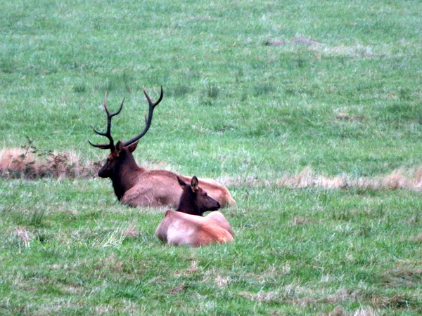
We got back on northbound 101 to the town of Orick where we saw another elk herd near the road. We stopped and took a few snapshots, especially of the large bull elk. We learned that this herd are Roosevelt Elk, but that California has these as well as Tule and Rocky Mountain Elk. After leaving the elk herd, we drove to the Prairie Creek State Park where there are often elk herds. We didn’t see elk there but found a bench where we ate our usual travel lunch of Ritz crackers and peanut butter.
on the Big Tree Trail

After leaving the visitor center we took the Newton-Drury Scenic Parkway which parallels Highway 101. There were many pull off spots with short trails to selected trees. We opted for the Big Tree Trail that features a redwood of impressive proportions and was named Big Tree. Other trees in the park have been found to be larger, but this tree is still very impressive and very accessible. We also walked the Circle Trail at the same trailhead. We drove a little further north on the Scenic Parkway to the Cathedral Trail that took us to many very large redwood trees as well as through redwood sorrel and many species of ferns. Our last stop on this road was the Ah-Pah Interpretive Trail that is a reclaimed logging road that has been returned to the contour and vegetation that was originally at the location.
False Klamath Bay

We returned to Highway 101 and drove toward Coos Bay, Oregon. We made a few stops along the way for especially scenic views as we drove along the Pacific Coast of Northern California. False Klamath Bay has some beautiful sea stacks with huge waves crashing all around them. There was still low visibility that may or may not have been due to the wildfires in the area. We didn’t smell smoke as strongly as we did earlier in the day, so we were thinking that this is just fog that is limiting our visibility.
Sea Lions at Crescent City, CA

Our last stop of the day was at Crescent City, one of the northernmost towns in California. We drove out on a spit where fishing boats go out each day. There were several small restaurants and food shacks serving fresh seafood. We drove to near the tip of the spit where dozens of sea lions congregate on platforms a few yards from the docks. They were being very vocal and vying for space on the floating platforms. We watched them for a while as we talked with the Koehlers on the cell phone. After about 30 minutes, we continued on toward Coos Bay.

We arrived our Super 8 in Coos Bay, Oregon around 5:30 pm and checked in to our first floor room easily. Our room was small but clean and convenient. We went out to a grocery store to pick up yogurt, fruit and snacks for Friday's drive then went for dinner. Mary found a highly reviewed local seafood restaurant, The Boat. This restaurant is constructed an old boat and a repurposed shipping container. Mary had a halibut fish and chips meal then helped me with the captain’s platter. We both thought that our meals were very good. We started sitting at a table outside, but the wind was a little sharp. We moved into the covered area that wasn’t heated but was sheltered from the wind. We chatted briefly with a local couple as we enjoyed our meals, then got the rental car filled up before going in for the night. 
We were pleased that gas prices here in Southern Oregon are a dollar per gallon less than in Northern California. Buying gas that is nearly $4 per gallon will take some getting used to since we were paying $1.78 per gallon back in Kentucky. We had forgotten that Oregon is one of two US states where gas stations are all full service. That will also take some getting used to. We hope to get a good night’s sleep in preparation for a long drive on Friday north through Oregon to Aberdeen, Washington.